


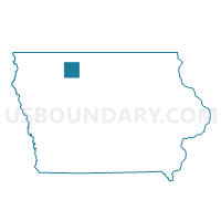
MALLARD Voting District, Palo Alto County, Iowa
About
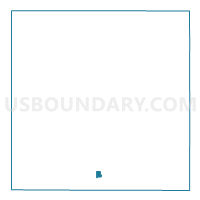
Outline

Summary
| Unique Area Identifier | 583001 |
| Name | MALLARD Voting District |
| County | Palo Alto County |
| State | Iowa |
| Area (square miles) | 0.41 |
| Land Area (square miles) | 0.41 |
| Water Area (square miles) | 0.00 |
| % of Land Area | 100.00 |
| % of Water Area | 0.00 |
| Latitude of the Internal Point | 42.93938950 |
| Longtitude of the Internal Point | -94.68315950 |
Maps

Graphs
Select a template below for downloading or customizing gragh for MALLARD Voting District, Palo Alto County, Iowa


Neighbors
Neighoring Voting District (by Name) Neighboring Voting District on the Map
- ELLINGTON TWP W/O MALLARD Voting District, Palo Alto County, IA
- RUSH LAKE TWP W/O MALLARD Voting District, Palo Alto County, IA